
Education and Training Materials
Remote Sensing Courses
| Boise State University |
|
Geog 361/561: Remote Sensing (3 credits, fall semester) •
Boise State campus live offering only |
| Idaho State University |
|
Geol 4409/5509: Remote sensing
(3 credits, spring semester) • Live and distance learning: Idaho Falls, Pocatello, Boise |
| University of Idaho |
|
FOR 375: Introduction to geospatial analysis for natural resource management |
The Boise River: From Snow to River to You
|
Idaho State University BCAL undergraduate Carol Moore developed and produced a video to educate 4th-6th graders about the Boise watershed, where their water comes from, and the many uses of that water in the Treasure Valley, Idaho. The video uses LiDAR, GIS data, Google Earth, photography, diagrams, narration, and musical composition to convey the importance of understanding water resources. This video was produced in partnership with the NRCS Snow Survey, Boise WaterShed Environmental Education Center, and Bogus Basin Snow School. Funding for the video was provided by the NSF Idaho EPSCoR Program and by the National Science Foundation under award number EPS-0814387. This video has been recognized by USDA NRCS scientists throughout Idaho, California, Oregon, and Nebraska as a 'great learning tool'! Watch video on:
|
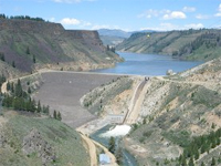 Boise River |
Interactive Water Quality Map
|
ISU BCAL students Sara Ehinger and Carol Moore developed an interactive water quality map for the Idaho Department of Environmental Quality to be used with middle school students. The interactive map uses Google Earth and GIS layers of the Lower Portneuf river valley aquifer, wells, and septic permit locations. This project was supported by the Idaho EPSCoR Program and the National Science Foundation. → Download documentation demonstrating map use. Formats: DOCX | PDF |
 Interactive Water Quality Map |
For information about remote sensing education and training, please contact:
Dr. Jan U.H. Eitel
Research Assistant Professor
University of Idaho, McCall Field Campus and McCall Outdoor Science School
Geospatial Laboratory for Environmental Dynamics
College of Natural Resources
875 Perimeter Drive, MS 1135
Moscow, ID 83844-1135
Phone: 208-596-9277
Skype: jansteeple
Email: jeitel@uidaho.edu