
LiDAR Data
|
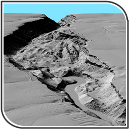
LiDAR (Light Detection And Ranging) is an optical remote sensing technology that measures properties of scattered light to find range and/or other information of a distant target. LiDAR technology is ideal for rapid, accurate, and detailed topographic surveys. [Read more]
Applications: LiDAR technology has application in Geomatics, archaeology, geography, geology, geomorphology, seismology, forestry, remote sensing and atmospheric physics. |
|